


01 South Holston Ruritan Voting District, Sullivan County, Tennessee
About
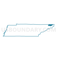
Outline

Summary
| Unique Area Identifier | 669792 |
| Name | 01 South Holston Ruritan Voting District |
| County | Sullivan County |
| State | Tennessee |
| Area (square miles) | 35.65 |
| Land Area (square miles) | 32.32 |
| Water Area (square miles) | 3.34 |
| % of Land Area | 90.64 |
| % of Water Area | 9.36 |
| Latitude of the Internal Point | 36.51717410 |
| Longtitude of the Internal Point | -82.06798860 |
Maps


Graphs
Select a template below for downloading or customizing gragh for 01 South Holston Ruritan Voting District, Sullivan County, Tennessee


Neighbors
Neighoring Voting District (by Name) Neighboring Voting District on the Map
- 02VP Valley Pike School Voting District, Sullivan County, TN
- 03 Hickory Tree Firehall Voting District, Sullivan County, TN
- 19H East Cherokee School Voting District, Sullivan County, TN
- 21 East High School Voting District, Sullivan County, TN
- 22 Holston Valley Middle School Voting District, Sullivan County, TN
- 6A Shady Voting District, Johnson County, TN
- Midway Voting District, Carter County, TN
- Unaka Voting District, Carter County, TN
Top 10 Neighboring County Subdivision (by Population) Neighboring County Subdivision on the Map
- District 4, Sullivan County, TN (18,932)
- District 5, Sullivan County, TN (14,013)
- District 1, Carter County, TN (7,651)
- District 1, Sullivan County, TN (6,876)
- District 6, Johnson County, TN (1,018)
Top 10 Neighboring Unified School District (by Population) Neighboring Unified School District on the Map
- Sullivan County School District, TN (84,038)
- Carter County School District, TN (43,248)
- Johnson County School District, TN (18,244)
Top 10 Neighboring State Legislative District Lower Chamber (by Population) Neighboring State Legislative District Lower Chamber on the Map
- State House District 3, TN (60,934)
- State House District 4, TN (57,424)
- State House District 1, TN (55,677)
Top 10 Neighboring State Legislative District Upper Chamber (by Population) Neighboring State Legislative District Upper Chamber on the Map
Top 10 Neighboring 111th Congressional District (by Population) Neighboring 111th Congressional District on the Map
Top 10 Neighboring Census Tract (by Population) Neighboring Census Tract on the Map
- Census Tract 713, Carter County, TN (7,317)
- Census Tract 432.02, Sullivan County, TN (4,967)
- Census Tract 430, Sullivan County, TN (4,692)
- Census Tract 431, Sullivan County, TN (3,080)
- Census Tract 9560, Johnson County, TN (1,018)